Share Onkaparinga River condition assessment on FacebookShare Onkaparinga River condition assessment on TwitterShare Onkaparinga River condition assessment on LinkedinEmail Onkaparinga River condition assessment link
Upcoming Onkaparinga River field survey
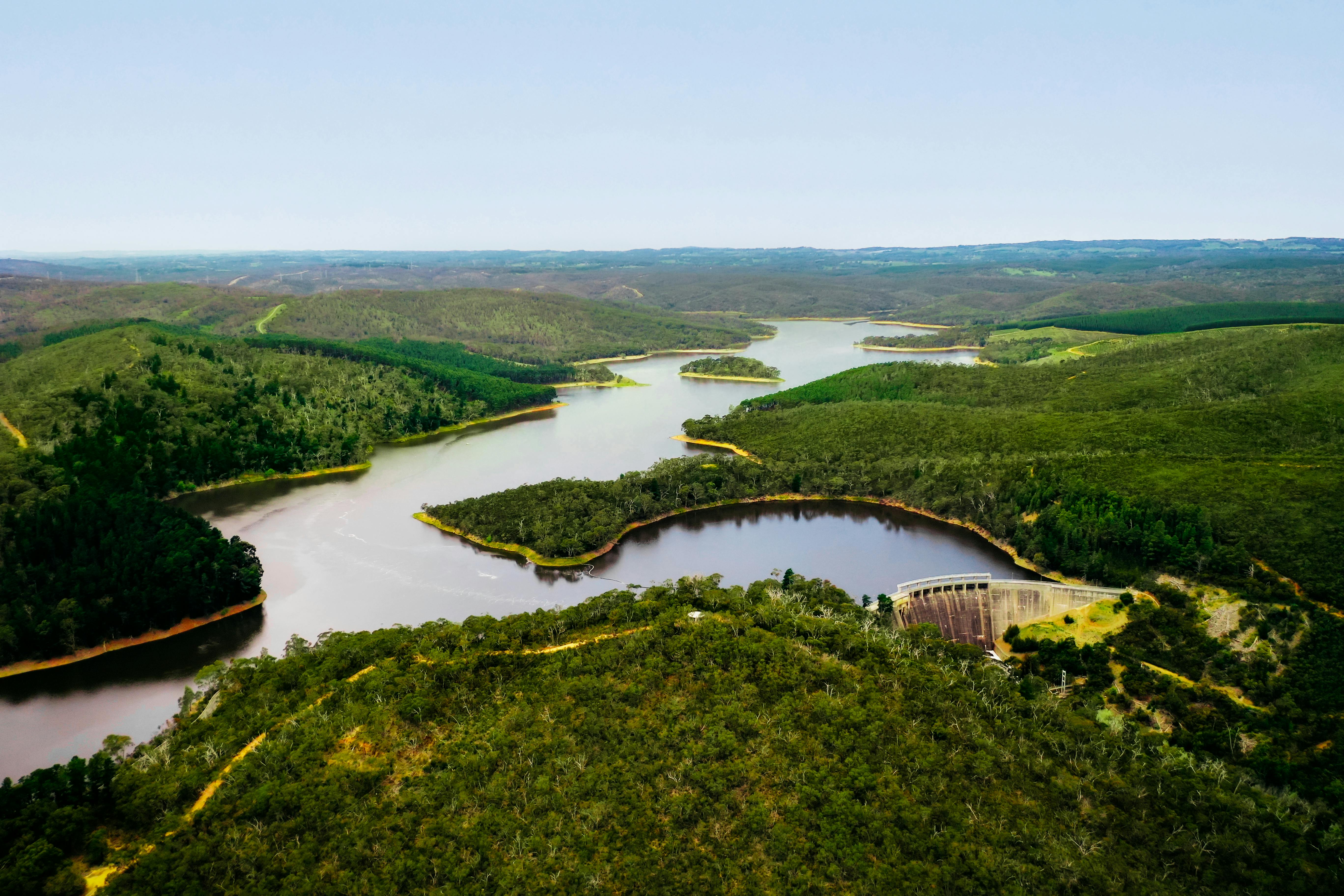
As part of managing drinking water catchments, SA Water and the Hills and Fleurieu Landscapes Board have engaged Water Technology to undertake a watercourse condition assessment of the Onkaparinga River between Spoehr Road and Mount Bold Reservoir.
This survey will help us to understand the range of environmental variables which may influence river conditions and impact watercourse health.
When it is happening
The survey is scheduled throughout May 2025, and will take approximately five days to complete, depending on weather and other factors such as water transfers and weather. Working hours will be within 7am to 5pm Monday to Friday.
What you need to know
Access to the river via private property, including your property, may be required in some areas.
Please fill out the below Landholder Permission form to indicate whether you are happy for our team to access your property for a short time to survey the watercourse.
We appreciate that landholders may wish to provide their perspectives regarding watercourse health, understand objectives of the program and how the information may be used. Recognising this, we are asking people to register their interest to a community drop-in session through the Landholder Permission form, and we will be in contact with you once the details are available.
We have also included a Landholder Survey if you would prefer this approach for sharing your views or feedback regarding the Onkaparinga River along your property.
Keeping you informed
Should you have any queries relating to this notification, please feel free to email reservoirs@sawater.com.au using the subject line: Onkaparinga River Field Survey.
Upcoming Onkaparinga River field survey
As part of managing drinking water catchments, SA Water and the Hills and Fleurieu Landscapes Board have engaged Water Technology to undertake a watercourse condition assessment of the Onkaparinga River between Spoehr Road and Mount Bold Reservoir.
This survey will help us to understand the range of environmental variables which may influence river conditions and impact watercourse health.
When it is happening
The survey is scheduled throughout May 2025, and will take approximately five days to complete, depending on weather and other factors such as water transfers and weather. Working hours will be within 7am to 5pm Monday to Friday.
What you need to know
Access to the river via private property, including your property, may be required in some areas.
Please fill out the below Landholder Permission form to indicate whether you are happy for our team to access your property for a short time to survey the watercourse.
We appreciate that landholders may wish to provide their perspectives regarding watercourse health, understand objectives of the program and how the information may be used. Recognising this, we are asking people to register their interest to a community drop-in session through the Landholder Permission form, and we will be in contact with you once the details are available.
We have also included a Landholder Survey if you would prefer this approach for sharing your views or feedback regarding the Onkaparinga River along your property.
Keeping you informed
Should you have any queries relating to this notification, please feel free to email reservoirs@sawater.com.au using the subject line: Onkaparinga River Field Survey.
As a landholder along the Onkaparinga River, you are an important stakeholder who influences our ability for Water Technology Pty Ltd – who have been engaged by SA Water and the Hills and Fleurieu Landscape Board – to assess the condition of the watercourse.
We are seeking your consent to access your property for a short period of time to complete a visual inspection of the Onkaparinga River channel. This visual inspection will include assessment of erosion issues or other factors which impact the condition of the watercourse.
Authorised persons entering your property will carry identification which can be produced at any time.
Where you give your consent, we will confirm the upcoming property access, activities and details 48 hours before the agreed property access, and on the day of the access prior to entry, or as otherwise agreed with you.
We acknowledge that requesting access to private property can raise questions, and the team would be more than happy to discuss any issues or concerns you may have with this request.
In addition to this, the team are also planning to host a community drop-in session. While we are still in the planning stages, please register your interest below and we will be in touch with the details once confirmed.
Share Landholder permission form on FacebookShare Landholder permission form on TwitterShare Landholder permission form on LinkedinEmail Landholder permission form link
Thank you for taking the time to complete this survey and provide your views regarding the condition of the Onkaparinga River. This survey should only take around 10 minutes to complete.
To get started, please tell us a little about you and your property